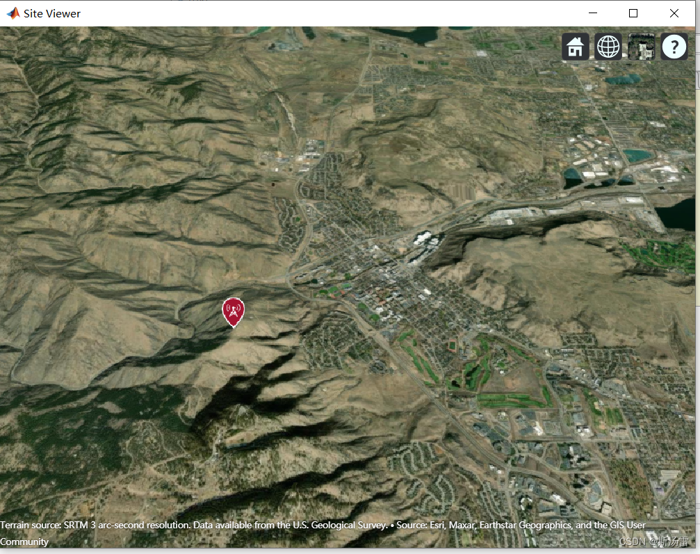
matlab 显示三维地图
发布时间:2024年01月10日
clc
% dtedfile = "n39_w106_3arc_v2.dt1";
% attribution = "SRTM 3 arc-second resolution. Data available " + ...
%    "from the U.S. Geological Survey.";
% addCustomTerrain("southboulder",dtedfile,"Attribution",attribution);
viewer = siteviewer("Terrain","southboulder");

tx_Latitude=39.74356;     %改动42.3001;
tx_Longitude=-105.24193;    %改动-71.3504;
tx = txsite('Name','MathWorks Apple Hill',...
    'Latitude',tx_Latitude, ...
    'Longitude',tx_Longitude);
show(tx)
文章来源:https://blog.csdn.net/qq_22163371/article/details/135499208
本文来自互联网用户投稿,该文观点仅代表作者本人,不代表本站立场。本站仅提供信息存储空间服务,不拥有所有权,不承担相关法律责任。 如若内容造成侵权/违法违规/事实不符,请联系我的编程经验分享网邮箱:chenni525@qq.com进行投诉反馈,一经查实,立即删除!
本文来自互联网用户投稿,该文观点仅代表作者本人,不代表本站立场。本站仅提供信息存储空间服务,不拥有所有权,不承担相关法律责任。 如若内容造成侵权/违法违规/事实不符,请联系我的编程经验分享网邮箱:chenni525@qq.com进行投诉反馈,一经查实,立即删除!
最新文章
- Python教程
- 深入理解 MySQL 中的 HAVING 关键字和聚合函数
- Qt之QChar编码(1)
- MyBatis入门基础篇
- 用Python脚本实现FFmpeg批量转换
- 电子图册可以使用二维码分享吗
- sizeof与strlen的使用及其区别
- 25.Java程序设计-基于SSM框架的微信小程序校园求职系统的设计与实现
- C语言关键字中英翻译机(用文件实现),有进阶(扩展了一个小游戏超有趣)
- MATLAB - 使用运动学 DH 参数构建机械臂
- PyCharm安装PyQt5一系列工具
- SpringCloud 分布式事务
- Flutter Android开发实用技巧
- 第九讲_css渐变
- 华为ensp网络设计期末测试题-复盘