基于MATLAB计算无线通信覆盖(一)环境准备
发布时间:2024年01月16日
一、环境
- MATLAB 2022b
注:开始仿真前需部署地理坐标区和地理图,最好采用第三种,直接把底图数据下载到本地,防止连接不上网络时只能显示darkwater的底图。

可用于地理坐标区和地理图的底图如下表所示
二、下载底图并安装
- 工具:SupportSoftwareDownloader,安装地址
- 安装方法见博文:超简单的Matlab附加功能安装包的安装方法
安装完成以后,点击附加功能-->管理附加功能,可以在已安装中看到现在就已经有了底图。

三、测试
- 例子采用MATLAB自带的,命令行输入代码:
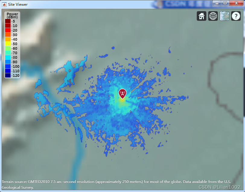
openExample('spc_channel/ModelCoverageUsingLongleyRiceModelExample')Model Coverage Using Longley-Rice Model Display the coverage area for a transmitter using the Longley-Rice model. pm = propagationModel("longley-rice"); tx = txsite("Name","Apple Hill","Latitude",39.9,"Longitude",116.4); coverage(tx,pm,"SignalStrengths",-100:-5)运行上述代码,得到下面的图像,即使用 Longley-Rice 模型显示发射机的覆盖区域。

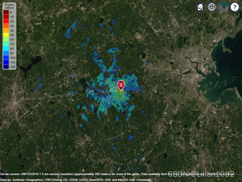
此时的底图使用的是Colorterrian,即彩色地形图,除此以外,可以选择的底图有:'bluegreen'、'grayland'、'grayterrain'、'landcover',可以看到此时是看不到卫星图,而原例子中的卫星图是这样的。

后面继续对如何得到卫星图的覆盖图像进行探索。?
文章来源:https://blog.csdn.net/xiaoliuhexiaolu/article/details/135619766
本文来自互联网用户投稿,该文观点仅代表作者本人,不代表本站立场。本站仅提供信息存储空间服务,不拥有所有权,不承担相关法律责任。 如若内容造成侵权/违法违规/事实不符,请联系我的编程经验分享网邮箱:chenni525@qq.com进行投诉反馈,一经查实,立即删除!
本文来自互联网用户投稿,该文观点仅代表作者本人,不代表本站立场。本站仅提供信息存储空间服务,不拥有所有权,不承担相关法律责任。 如若内容造成侵权/违法违规/事实不符,请联系我的编程经验分享网邮箱:chenni525@qq.com进行投诉反馈,一经查实,立即删除!
最新文章
- Python教程
- 深入理解 MySQL 中的 HAVING 关键字和聚合函数
- Qt之QChar编码(1)
- MyBatis入门基础篇
- 用Python脚本实现FFmpeg批量转换
- 解决ImportError: cannot import name ‘url_quote‘ from ‘werkzeug.urls‘
- SpringBoot实现热部署
- VS Code中文改成空格,把空行去掉
- java中反射的实际应用
- 读元宇宙改变一切笔记11_区块链
- 保持数据同步:高并发场景下的数据库与缓存一致性维护策略
- 解决方案|镭速加速传输技术助推芯片行业创新发展
- Ai创建一个文档
- 2024年了,抖店还能不能做?开店和没开店的都可以看下!
- Hotspot源码解析-第21章-引用处理器和JNI句柄初始化
