geemap学习笔记039:分析地理空间数据--合成无云影像
发布时间:2024年01月03日
前言
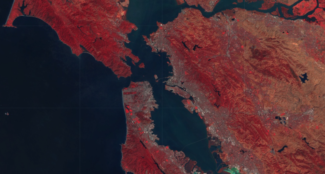
本节介绍的内容是对于众多的原始Landsat数据,利用ee.Algorithms.Landsat.simpleComposite()将其处理为TOA数据,并且合成无云影像。
1 导入库并显示地图
import ee
import geemap
ee.Initialize()
2 无云影像合成
Map = geemap.Map()

collection = ee.ImageCollection('LANDSAT/LC08/C02/T1').filterDate(
    '2021-01-01', '2022-01-01'
)

composite = ee.Algorithms.Landsat.simpleComposite(collection) #对来源于原始的Landsat数据计算一个合成的TOA数据,它选择每个点的最低可能范围的云分数

vis_params = {'bands': ['B5', 'B4', 'B3'], 'max': 128}

Map.setCenter(-122.3578, 37.7726, 10)
Map.addLayer(composite, vis_params, 'TOA composite')
Map

customComposite = ee.Algorithms.Landsat.simpleComposite(
    **{'collection': collection, 'percentile': 30, 'cloudScoreRange': 5}
)  # percentile:云分数的百分位;cloudScoreRange:每个像素接受的云分数范围的大小。

Map.addLayer(customComposite, vis_params, 'Custom TOA composite')
Map.setCenter(-105.4317, 52.5536, 11)
后记
大家如果有问题需要交流或者有项目需要合作,可以加Q Q :504156006详聊,加好友请留言“CSDN”,谢谢。
文章来源:https://blog.csdn.net/qq_41951977/article/details/135270725
本文来自互联网用户投稿,该文观点仅代表作者本人,不代表本站立场。本站仅提供信息存储空间服务,不拥有所有权,不承担相关法律责任。 如若内容造成侵权/违法违规/事实不符,请联系我的编程经验分享网邮箱:chenni525@qq.com进行投诉反馈,一经查实,立即删除!
本文来自互联网用户投稿,该文观点仅代表作者本人,不代表本站立场。本站仅提供信息存储空间服务,不拥有所有权,不承担相关法律责任。 如若内容造成侵权/违法违规/事实不符,请联系我的编程经验分享网邮箱:chenni525@qq.com进行投诉反馈,一经查实,立即删除!
最新文章
- Python教程
- 深入理解 MySQL 中的 HAVING 关键字和聚合函数
- Qt之QChar编码(1)
- MyBatis入门基础篇
- 用Python脚本实现FFmpeg批量转换
- Alibaba分布式事务组件Seata AT实战
- 反向传播和梯度下降-1
- 高性能计算HPC与统一存储
- 【动态规划】【C++算法】639 解码方法 II
- 02-SpringCloud-Eureka注册中心
- Java虚拟机知识点总结
- OLED显示实验
- MacBook安装Storm与启动
- BQ25898DYFFR 4A电池充电器、D2315-5R0E贴片电感、PMZ290UNE2和PB5A2BX均是N型场效应管(MOSFET)
- 准备用vscode代替sourceinsight