arcgis javascript api4.x以basetilelayer方式加载天地图web墨卡托(wkid:3857)坐标系
发布时间:2024年01月15日
需求:
arcgis javascript api4.x以basetilelayer方式加载天地图web墨卡托(wkid:3857)坐标系
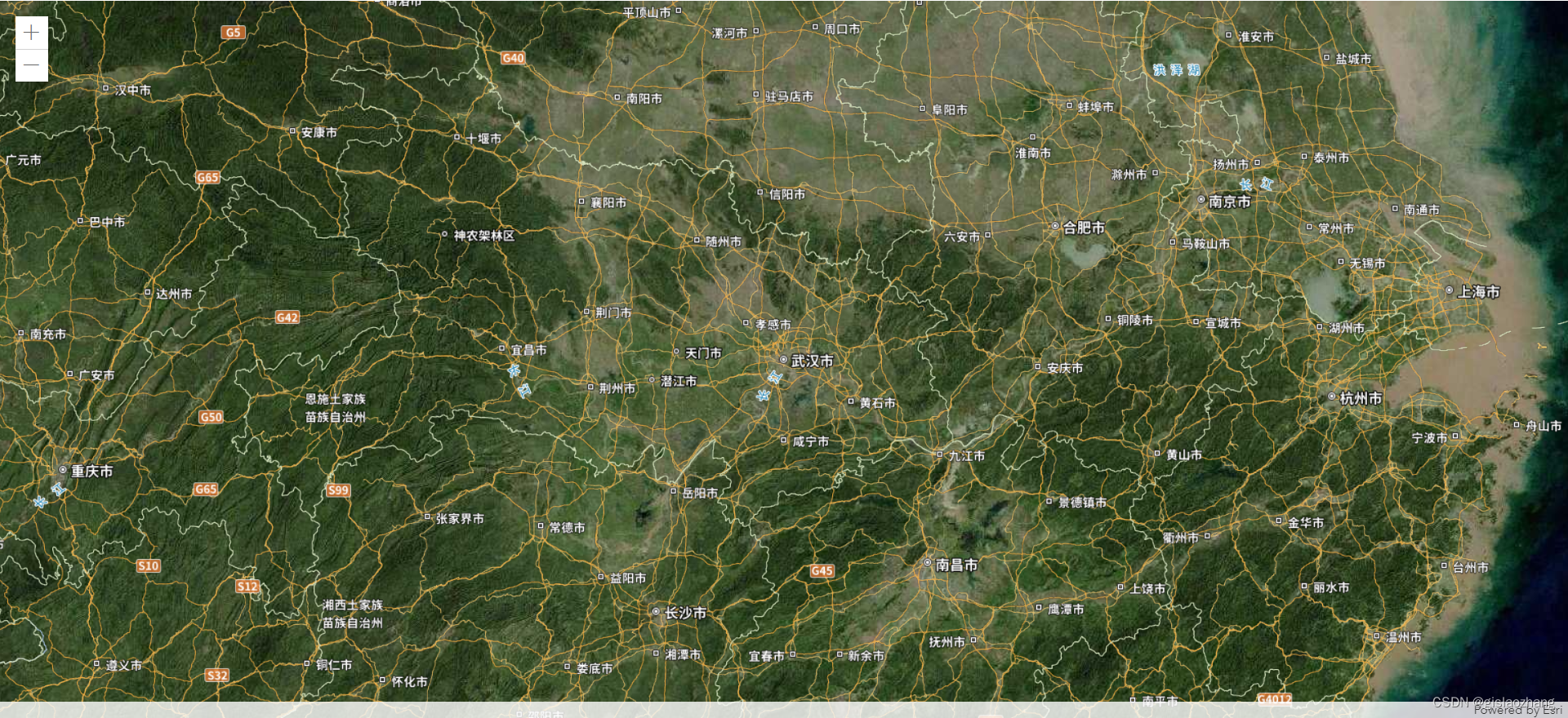
效果图:
代码:
提示:
2个文件放同一个文件夹下
MyCustomTileLayer.js
define(['exports', "esri/layers/BaseTileLayer","esri/request"], function (
    exports,
    BaseTileLayer,
    esriRequest
  ) {
    const MyCustomTileLayer = BaseTileLayer.createSubclass({
            // properties of the custom tile layer
            properties: {
              urlTemplate: null,
            },

          // override getTileUrl()
          // generate the tile url for a given level, row and column
          getTileUrl: function (level, row, col) {
            return this.urlTemplate.replace("{level}", level).replace("{col}", col).replace("{row}", row);
          },

          // This method fetches tiles for the specified level and size.
          // Override this method to process the data returned from the server.
          fetchTile: function (level, row, col, options) {

            // call getTileUrl() method to construct the URL to tiles
            // for a given level, row and col provided by the LayerView
            var url = this.getTileUrl(level, row, col);

            // request for tiles based on the generated url
            // the signal option ensures that obsolete requests are aborted
            return esriRequest(url, {
              responseType: "image",
              //signal: options && options.signal
               allowImageDataAccess: true
            })
              .then(function (response) {
                // when esri request resolves successfully
                // get the image from the response
                var image = response.data;
                var width = this.tileInfo.size[0];
                var height = this.tileInfo.size[0];

                // create a canvas with 2D rendering context
                var canvas = document.createElement("canvas");
                var context = canvas.getContext("2d");
                canvas.width = width;
                canvas.height = height;

                // Apply the tint color provided by
                // by the application to the canvas
                if (this.tint) {
                  // Get a CSS color string in rgba form
                  // representing the tint Color instance.
                  context.fillStyle = this.tint.toCss();
                  context.fillRect(0, 0, width, height);

                  // Applies "difference" blending operation between canvas
                  // and steman tiles. Difference blending operation subtracts
                  // the bottom layer (canvas) from the top layer (tiles) or the
                  // other way round to always get a positive value.
                  context.globalCompositeOperation = "difference";
                }

                // Draw the blended image onto the canvas.
                context.drawImage(image, 0, 0, width, height);

                return canvas;
              }.bind(this));
          }

        });

  return MyCustomTileLayer;
  })
loadtdt3857.html
<html>
    <head>
        <meta charset="utf-8" />
        <meta name="viewport" content="initial-scale=1, maximum-scale=1,user-scalable=no" />
        <title>(墨卡托)天地图加载</title>
        <style>
            html,
            body,
            #viewDiv {
                width: 100%;
            height: 100%;
            padding: 0;
            margin: 0;
            }
        </style>

        <link rel="stylesheet" href="https://js.arcgis.com/4.23/esri/css/main.css" />
        <script src="https://js.arcgis.com/4.23/init.js"></script>
        <script>
            require(["esri/Map",
                "esri/views/MapView",
                "esri/layers/GraphicsLayer",
                "esri/Graphic",
                "esri/PopupTemplate",
                "esri/widgets/Popup",
                "esri/layers/MapImageLayer",
                "esri/widgets/Legend",
                "esri/layers/WebTileLayer",
                "esri/layers/WMTSLayer",
                "esri/widgets/BasemapGallery/support/LocalBasemapsSource",
                "esri/widgets/BasemapGallery",
                "esri/Basemap",
                "esri/layers/FeatureLayer",
                "esri/geometry/Extent",
                "esri/geometry/SpatialReference",
                'esri/config','esri/layers/support/TileInfo',
                "./MyCustomTileLayer.js",
                "esri/layers/TileLayer",
            ], function(
                Map,
                MapView,
                GraphicsLayer,
                Graphic,
                PopupTemplate,
                Popup,
                MapImageLayer,
                Legend,
                WebTileLayer,
                WMTSLayer,
                LocalBasemapsSource,
                BasemapGallery,
                Basemap,
                FeatureLayer,
                Extent,
                SpatialReference,
                esriConfig,
                TileInfo,
                MyCustomTileLayer,
                TileLayer
            ) {
                var key = "天地图key"
                key = "6a92e00bdfafade25568c053a5ba6de4"
                // http://t0.tianditu.com/img_w/esri/wmts  可代替  http://t0.tianditu.gov.cn/img_w/wmts  效果一致
         var tiledLayer = new MyCustomTileLayer({
                    urlTemplate: "http://t0.tianditu.gov.cn/img_w/wmts?SERVICE=WMTS&REQUEST=GetTile&VERSION=1.0.0&LAYER=img&STYLE=default&TILEMATRIXSET=w&FORMAT=tiles&TileMatrix={level}&TileCol={col}&TileRow={row}&tk=" +
                        key,
                    id: '影像',
                    listMode: 'hide' //这个属性设置是为了在layerlist不显示出来
                });
                var tiledLayer_poi = new MyCustomTileLayer({
                    urlTemplate: "http://t0.tianditu.gov.cn/cia_w/wmts?SERVICE=WMTS&REQUEST=GetTile&VERSION=1.0.0&LAYER=cia&STYLE=default&TILEMATRIXSET=w&FORMAT=tiles&TileMatrix={level}&TileCol={col}&TileRow={row}&tk=" +
                        key,
                    id: '影像标记',
                    listMode: 'hide'
                });
                var tiledLayer1 = new MyCustomTileLayer({
                    urlTemplate: "http://t0.tianditu.gov.cn/vec_w/wmts?SERVICE=WMTS&REQUEST=GetTile&VERSION=1.0.0&LAYER=vec&STYLE=default&TILEMATRIXSET=w&FORMAT=tiles&TileMatrix={level}&TileCol={col}&TileRow={row}&tk=" +
                        key,
                    id: '矢量',
                    visible: false,
                    listMode: 'hide'
                });
                var tiledLayer_poi1 = new MyCustomTileLayer({
                    urlTemplate: "http://t0.tianditu.gov.cn/cva_w/wmts?SERVICE=WMTS&REQUEST=GetTile&VERSION=1.0.0&LAYER=cva&STYLE=default&TILEMATRIXSET=w&FORMAT=tiles&TileMatrix={level}&TileCol={col}&TileRow={row}&tk=" +
                        key,
                    id: '矢量标记',
                    visible: false,
                    listMode: 'hide'
                });


                var basemap = new Basemap({
                    baseLayers: [tiledLayer, tiledLayer_poi, tiledLayer1, tiledLayer_poi1],
                })
                var map = new Map({
                    basemap: basemap
                });


                var view = new MapView({
                    container: "viewDiv",
                    map: map,
                    spatialReference: {
                        wkid: 3857  //102100
                    },
                    center: [114.3115879,30.5943680], //113.27434372047993,22.722786885699826
                    linked: false,
                    zoom:7,
                });


            });
        </script>
    </head>

    <body class="calcite">
        <div id="viewDiv"></div>
    </body>
</html>
参考资料:
文章来源:https://blog.csdn.net/gislaozhang/article/details/135598330
本文来自互联网用户投稿,该文观点仅代表作者本人,不代表本站立场。本站仅提供信息存储空间服务,不拥有所有权,不承担相关法律责任。 如若内容造成侵权/违法违规/事实不符,请联系我的编程经验分享网邮箱:chenni525@qq.com进行投诉反馈,一经查实,立即删除!
本文来自互联网用户投稿,该文观点仅代表作者本人,不代表本站立场。本站仅提供信息存储空间服务,不拥有所有权,不承担相关法律责任。 如若内容造成侵权/违法违规/事实不符,请联系我的编程经验分享网邮箱:chenni525@qq.com进行投诉反馈,一经查实,立即删除!
最新文章
- Python教程
- 深入理解 MySQL 中的 HAVING 关键字和聚合函数
- Qt之QChar编码(1)
- MyBatis入门基础篇
- 用Python脚本实现FFmpeg批量转换
- SpringBoot 整合 Redis 缓存
- 原地建堆,LeetCode 1962. 移除石子使总数最小
- 行为型设计模式——责任链模式
- 7-36 复数四则运算 分数 15
- WebGL开发MR应用
- c#队列Queue的使用
- C++随机数生成:std标准库和Qt自带方法(未完待续)
- 代码随想录补|leetcode 46、47全排列问题
- 【dataframe】将dataframe中的数据保存到csv文件或txt文件中
- WiFi7: MLO操作之AP MLD的发现—AP的行为